
Permanent establishment of route, passing Nnorth of “South Hook Buoy” & replacement of “South Hook Buoy” Cardinal Mark, with a special mark.
- MARINERS ARE HEREBY ADVISED, that following the conclusion of a trial and assessing the feedback on the routing of vessels North of the South Hook Buoy, that this has been efficient and beneficial to safe navigation. Therefore, the following changes are to take effect immediately.
- Vessels, whose draft and minimum safe under-keel clearance allows, are able to transit North of South Hook Buoy through the established route as depicted in red on the chartlet below:
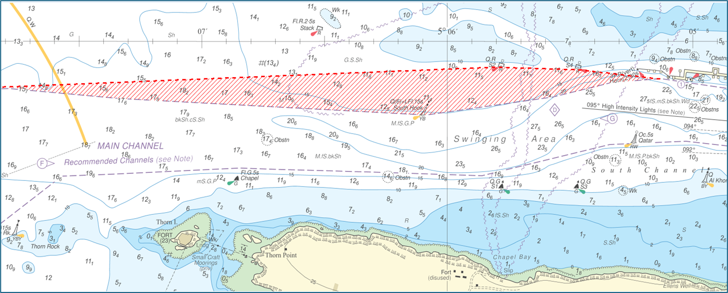
New established route North of the South hook buoy.
- This area remains bounded by the coordinates previously defined:
- 51o90843N, 005o 05.13198W
- 51o93091N, 005o 05.46723W
- 51o93694N, 005o 05.77955W
- 51o87870N, 005o 08.13228W
The control depth remains at 11.1m.
- VTS Clearance Requirement: Vessels intending to transit north of South Hook Buoy must request clearance at the earliest opportunity and no later than when passing either Reporting Point “F” (Thorn Rock) inbound, or Reporting Point “G” (Qatar Buoy) when outbound.
- The requirement for mariners to navigate via the South Channel remains in effect when South Hook berths are occupied, considering prevailing conditions, shipping traffic, vessel’s size and draft.
- The South Hook South Cardinal Buoy will be replaced by an appropriate Special Mark Buoy in the next scheduled buoy maintenance program.
- Please contact Milford Haven VTS for further information:
- VHF: channel 12
- Email: vts@mhpa.co.uk
- Telephone: 01646 696100
- Admiralty chart 3724, 3275 and IMRAY Y26 and 2600 atlas refer.
- This notice will self-cancel at 2359hrs 31 December 2025